Sensors & Software Inc.

Sensors & Software Inc. is recognized worldwide as an innovative designer and manufacturer of ground penetrating radar (GPR) instrumentation and software for numerous applications, including utility locating, concrete scanning, structural assessment, mining and quarrying, forensics, archaeology, geology, geotechnical and environmental assessment, glaciology, agriculture, and UXO detection.

Sensors & Software joined Radiodetection in November 2020 and now is a part of SPX Technologies, expanding Radiodetection’s ground penetrating radar (GPR) offering. With offices and a network of dealers worldwide, we are well-positioned to serve our existing customers and cultivate new markets

Designed to meet the needs of GPR professionals by addressing a wide range of GPR applications. The variety of components available allow for a truly customizable unit.

Download Brochures

pulseEKKO Ultra Receiver

Features include:

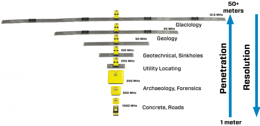
  • Multiple frequencies provide a variety of exploration depths and spatial resolutions required by different applications.
  • Lower frequency (LF) antennas with center frequencies and bandwidths of 12.5, 25, 50, 100 and 200 MHz connected to transmitter and receiver electronic modules.
  • Shielded, higher frequency (HF) transducers provide center frequencies and bandwidths of 250, 500 and 1000 MHz.
  • Several antennas and/or transducers can be deployed simultaneously when using SPIDAR hardware.
  • Multiple configurations and deployment methods provide practical field operation.
  • The fully bistatic configuration enables variable antenna offsets and orientations for advanced survey types such as multi-offset, trans-illumination and multi-polarization.
  • Data is collected and displayed on the DVL-500. The DVL-500 is a ruggedized display, with a high-visibility touchscreen, Wi-Fi compatibility and easy USB data export.
  • Acquired data is in Sensors & Software’s industry standard format. Post-processing and analysis can be accomplished by importing the data into the EKKO_Project software

pulseEKKO PRO Ultra Receiver can stack GPR traces thousands, even as many as one million times, resulting in deeper GPR penetration with signals 100 times smaller than before to overcomes the regulatory emission limits that currently constrain GPR exploration depth.

Powerful GPR data analysis for less time organizing, editing and processing GPR data to interpret and extract valuable insights. Consist of powerful modules that build onto EKKO_Project™ Core and expand to data analysis and visualization capabilities

Download Brochures

EKKO_Project Core LineView Interpretation SliceView Processing Voxler

Core : Organize GPR Data & report iInsights

  • entire project in a single view
  • attach photos and other files to project
  • view GPR line data
  • bird’s eye view of all the data in project
  • generate Reports in multiple file formats
  • displays depth slices on site photos
  • export lines to Point Cloud, DT1 and HD, SEG-Y,Text
  • spreadsheet CSV (positions & statistics of interpreted GPR targets)
  • CAD DXF files to import into AutoCAD or GIS software
  • Google Earth KMZ file that overlays layers of data on the Google Earth image of the survey site

LineView : Optimize GPR Line Data

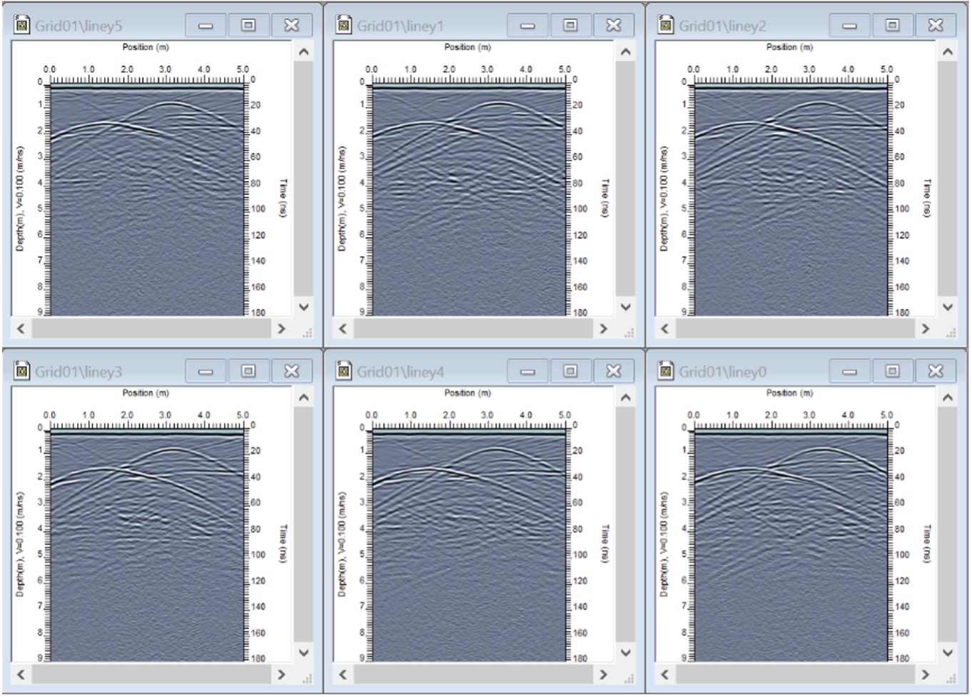
  • Plot and scroll multiple lines simultaneously to quickly identify targets
  • Selectable color palettes
  • Adjust Gain to ensure deeper, weaker targets are identified
  • Remove flat lying reflectors that mask target hyperbolas with the background subtraction filter

Interpretation : Add insights to GPR Data

  • Augment report by adding interpretations to the GPR lines: Points, Polylines, Boxes, Annotations
  • Plotting Interpretations in MapView
  • Add interpretations to multiple lines simultaneously
  • Add photos, videos and audio files to multi-media flags to assist with interpretations
  • Export interpretations to other file formats: Google Earth KMZ, Spreadsheet CSV, CAD, GIS

Sliceview : Display GPR Data as Depth Slices and Slice Down to Reveal Targets

  • visualize large volumes of grid data in a map view as a series of depth slices
  • process and display line data collected with an external GPS as depth slices

Processing : Edit and apply processing tools to GPR lines to further analyze the data

Editing

Instantaneous Attributes

· Cropping Position

· Envelope

· Cropping Time

· Frequency

· Padding Position

· Phase

· Padding Time


· Reverse Line


· Reposition Traces


· Reposition using GPS, Delete Traces, Insert Traces


Time Filters

Operations

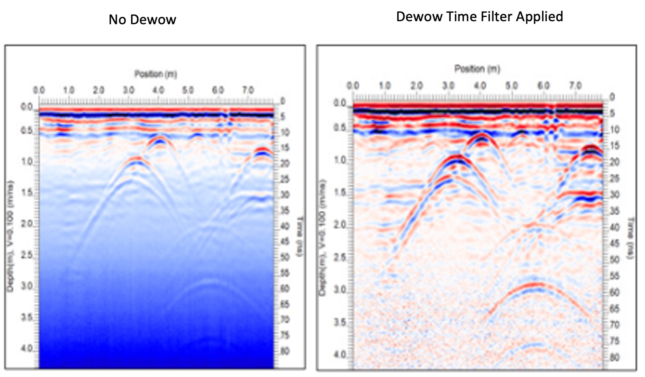
· Dewow

· Frequency Spectra

· DC

· CMP/WARR

· Removal

· Analysis

· Bandpass

· Mute Data

· Highpass

· NMO Correction

· Lowpass

· Rectify Traces

· Median

· Declip

· Vertical


· Deconvolution


· DynaT


Gains

Spatial Filters

· SEC

· Background Subtraction

· AGC

· Horizontal

· Constant

· Median


First Break

2D Filters

· Edit First Break

·  FK

· Repick First Break

·  Kirchhoff Migration

Voxler : Display Grid data as a 3D volume

  • variable opacity plots
  • combining volume plots
  • 3D GPR data

System Requirements

Operating System

Windows 10 (64-bit)

CPU

2 GHz or 3 GHz (recommended)

Screen Resolution

1024 x 768 pixels,

Storage

HDD – Hard Disk Drive, SSD – Solid State Drive (recommended)


500 MB