Landslide Characterization and Monitoring in French
Phoenix Geosystem
Main applications using IRIS products which could interest Indonesia: Natural hazards, groundwater management, environmental issues, geothermal exploration, mineral exploration, geotechnical issues.
Landslide Characterization and Monitoring in French
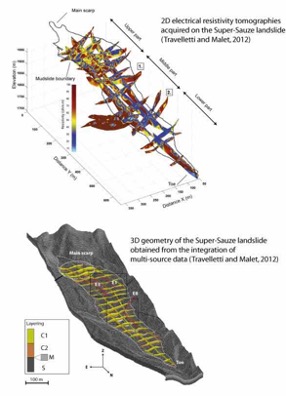
Electrical resistivity tomography (ERT) helps to:
image the slip surface at depth for landslide volume estimation
estimate soil water content variations with time
follow water infiltration with time
track internal deformation with time
Map of horizontal displacements measured in the Barcelonnette valley (South French Alps) from InSAR. One can observe the Super Sauze and the La Valette landslide.